[Back to TullyRunners Home Page]
| Vernon-Verona-Sherrill Course Map - 2004 |
... updated August 22, 2004
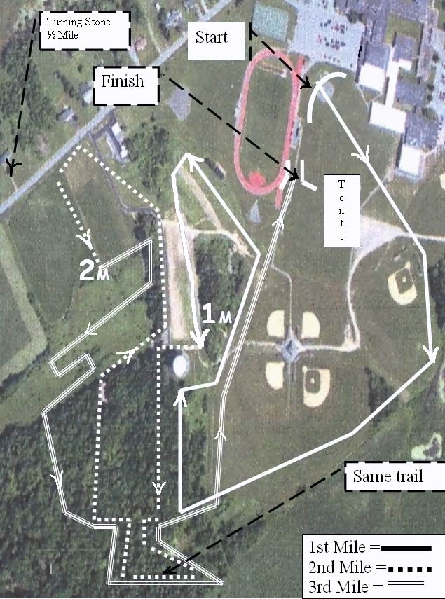
| Below is an aerial photograph showing
the VVS XC course for 2004 (thanks to Todd Bauer) ... NOTE:
the course for 2004 is not the same course as in previous years
... new trails have cut through the woods ... see the
photo-page for trail examples Some Ground Level PHOTOS of the course (separate page) On the map below, the large water tower is the white oval (circle) feature just below-left of the 1 Mile mark. |
|