[Back to TullyRunners Home Page]
| PHOTOS - Vernon-Verona-Sherrill Course - 2004 |
August 22, 2004
| General Impressions ...
The new VVS course is very good ... there are very few completely flat
areas on the course ... elevation changes are frequently occurring ...
sections of the course that appear easy are harder than they appear ...
for example (similar to the Tully course), if you run the first mile too
hard (thinking it's easy), it could be costly at the end of the race ...
The course has many direction changes, so knowledge of the course is
beneficial ... It's a good spectator course! Todd Bauer, Jason Merrill and the VVS co-workers have designed a challenging course ... many new trails have been cut through the wooded areas ... runners who like trail-running through forests should enjoy this course ... after entering the wooded areas, it gets easy to lose sight of runners ahead of you. Thanks to Todd Bauer & wife for the course tour. |
|
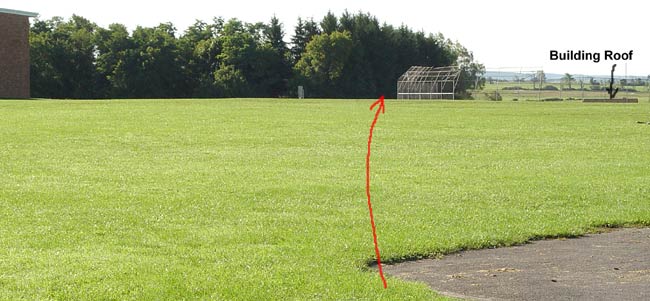
| The VVS Course starts near (or on) the softball field located near the end of the track (stadium) ... the red line shows the course around the baseball backstop (distance around backstop is farther than it appears in photo; about 300 meters) ... it is slight uphill then downhill past the backstop (note the roof of a building in the photo) ... the VVS high school building is close by (corner visible at far left). |
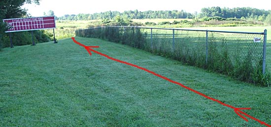 |
| After rounding the baseball backstop, the course goes between the baseball field fence and scoreboard ... past the scoreboard, it's downhill for a short distance. |
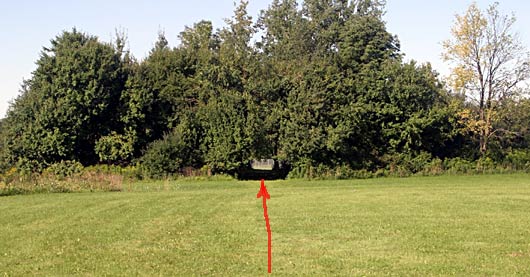 |
| There's a clump of trees between the two baseball fields with a "hole" through it ... on the other side is the home-run fence from the other baseball field. |
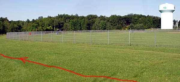 |
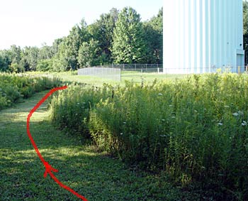
| Here's the baseball home-run fence ... in the background it the very prominent water-tower (very useful location marker for this course) |
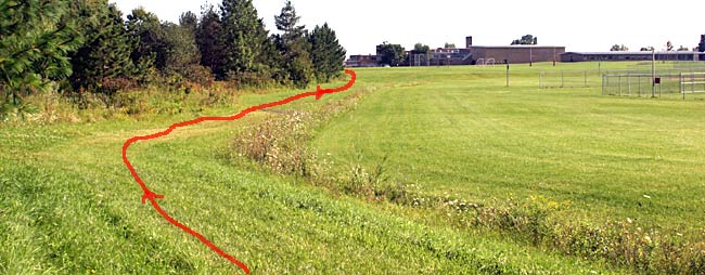 |
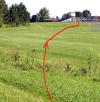
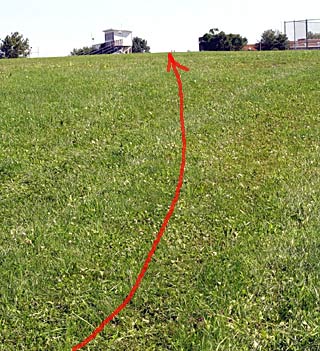
| This is approximately 3/4 of a mile into the race ... baseball field on the right ... school straight ahead (track just to the left of the school) |
 |
 |
| Steep uphill into the woods (steeper & longer than it appears in the photo) | Steep downhill, the up ... the course has numerous areas where it would be easy to "run other runners" off the trail (but that's not legal). |
 |
 |
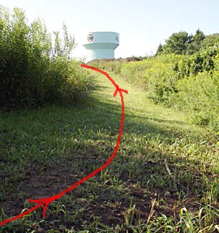
| Uphill to the water tower (about 1 mile into the race) | Running by the base of the water tower |
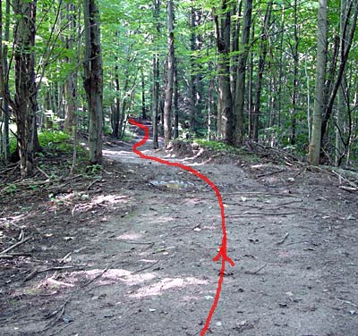 |
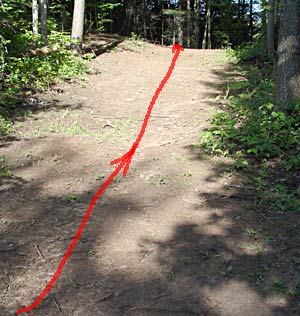
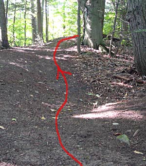
| One of the newly cut trails through the woods |
 |
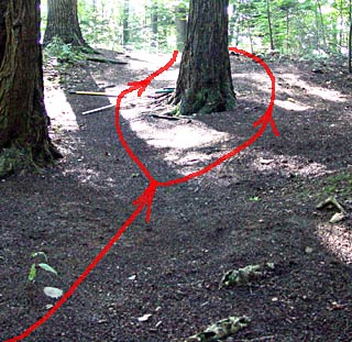 |
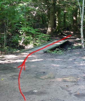
| Wooden bridge (that will be widened) about 1.25 miles into the race | A new uphill trail where a runner can take the "high road" or the "low-road" around a tree (or use the tree as a blocker). |
 |
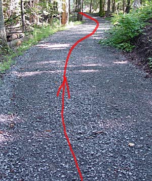 |
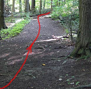
| Another typical trail through the woods (mostly dirt, can be muddy when wet) | A small road section ... rather than dirt, it has a stone (gravel) surface |
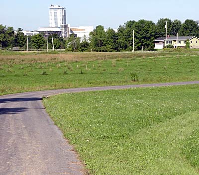 |
| About 1.75 miles into the race ... you can look directly at the Turning Stone Casino Hotel |
 |
 |
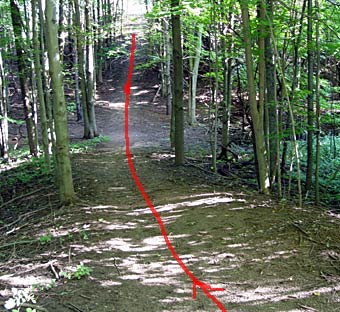
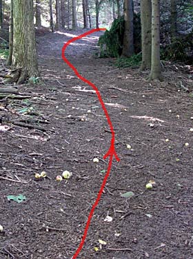
| More trails through the woods | An uphill trail leading to the "Blind Turn" about 1000 meters from the finish |
 |
| Out of the woods and approaching the finish (behind the track stadium grandstands) ... Note: the exact line to the finish to-be-determined |
 |
| Neat little surprise approaching the finish ... It's uphill |